J.H. Crawford, the author of Carfree Cities and Carfree Design Manual, has been a tireless advocate, researcher, and documentarian for beautiful places for more than 20 years.
In honor of the final edition of Crawford’s Carfree Times newsletter, we’ve created the first-ever 3D model of his fascinating reference district.
The Carfree Reference District
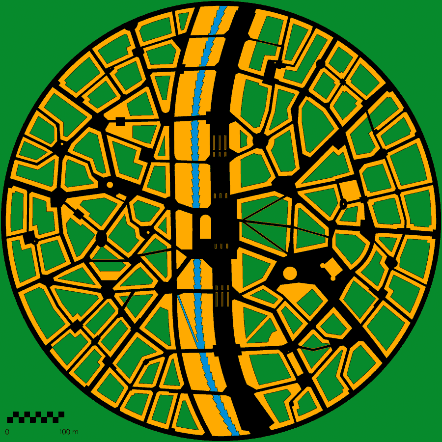
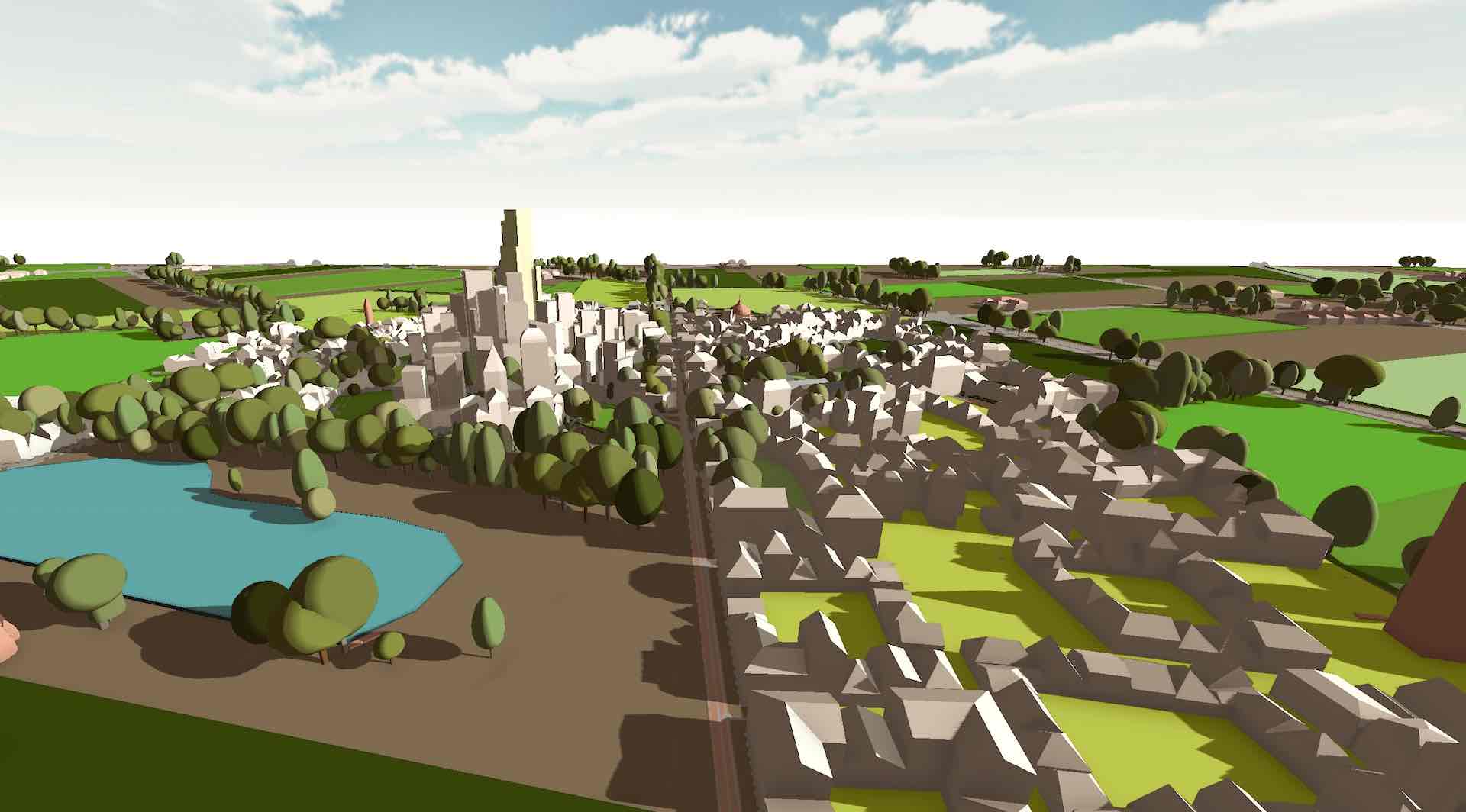
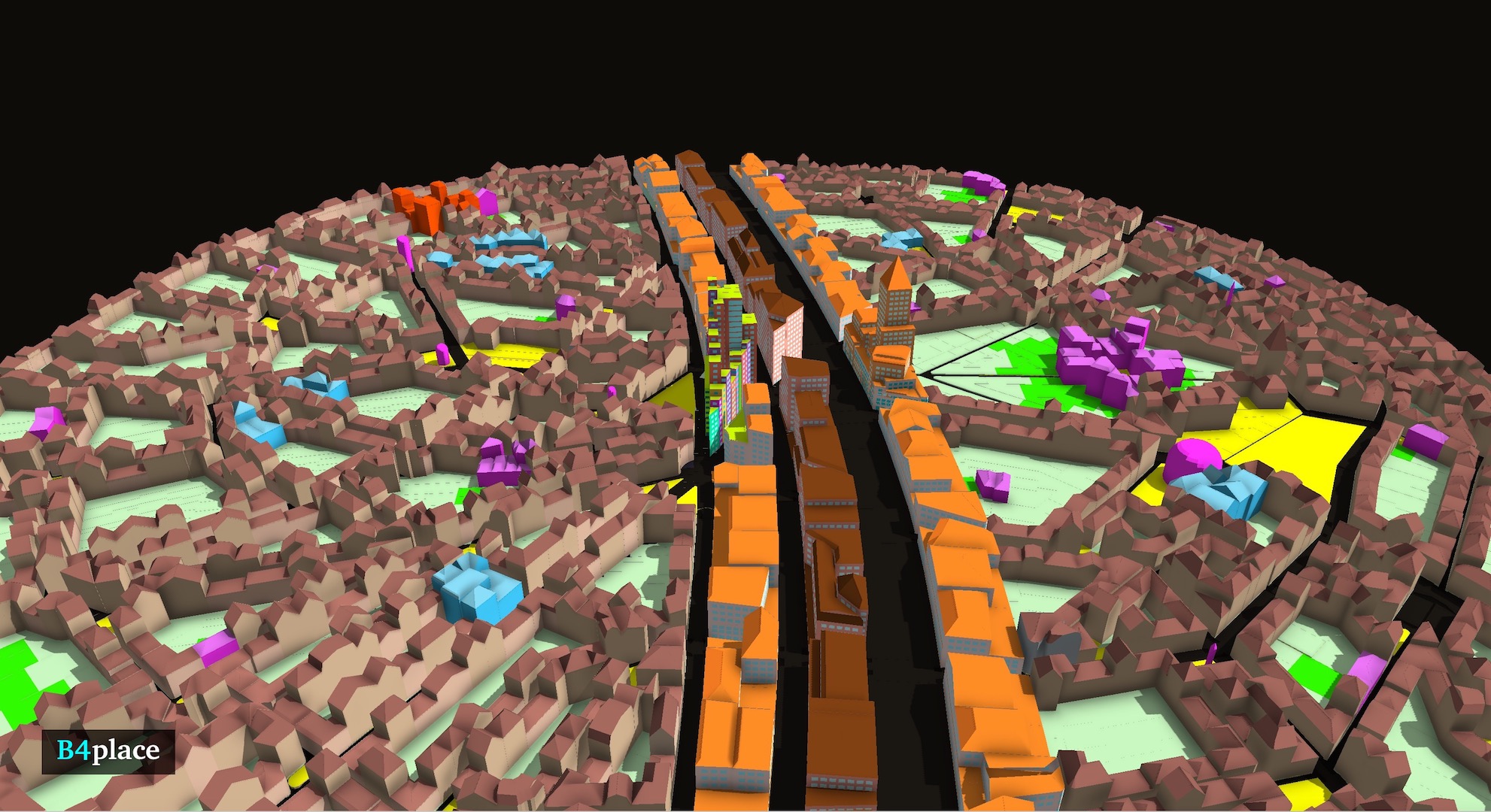
Crawford’s reference district serves as a template for creating carfree cities and towns, which he elaborates in his “carfree” books and on his website, carfree.com. In his vision, each district meets a number of certain design standards–the most fundamental being a loosely radial street grid built around a central transportation line.
Other defining features include zero-lot-line setbacks, connected smaller-scaled 3-5 story buildings around back gardens, and mixed-use forms. Moreover, the radial layout allows for minimized walking distances to the town center and the surrounding countryside.
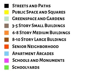
Also, the larger-scale buildings are placed along the central transport alignment, giving the main artery through the heart of the town a grand boulevard sort of feel. Crawford details the specific metrics and units here on his website.
A 3D Model Version
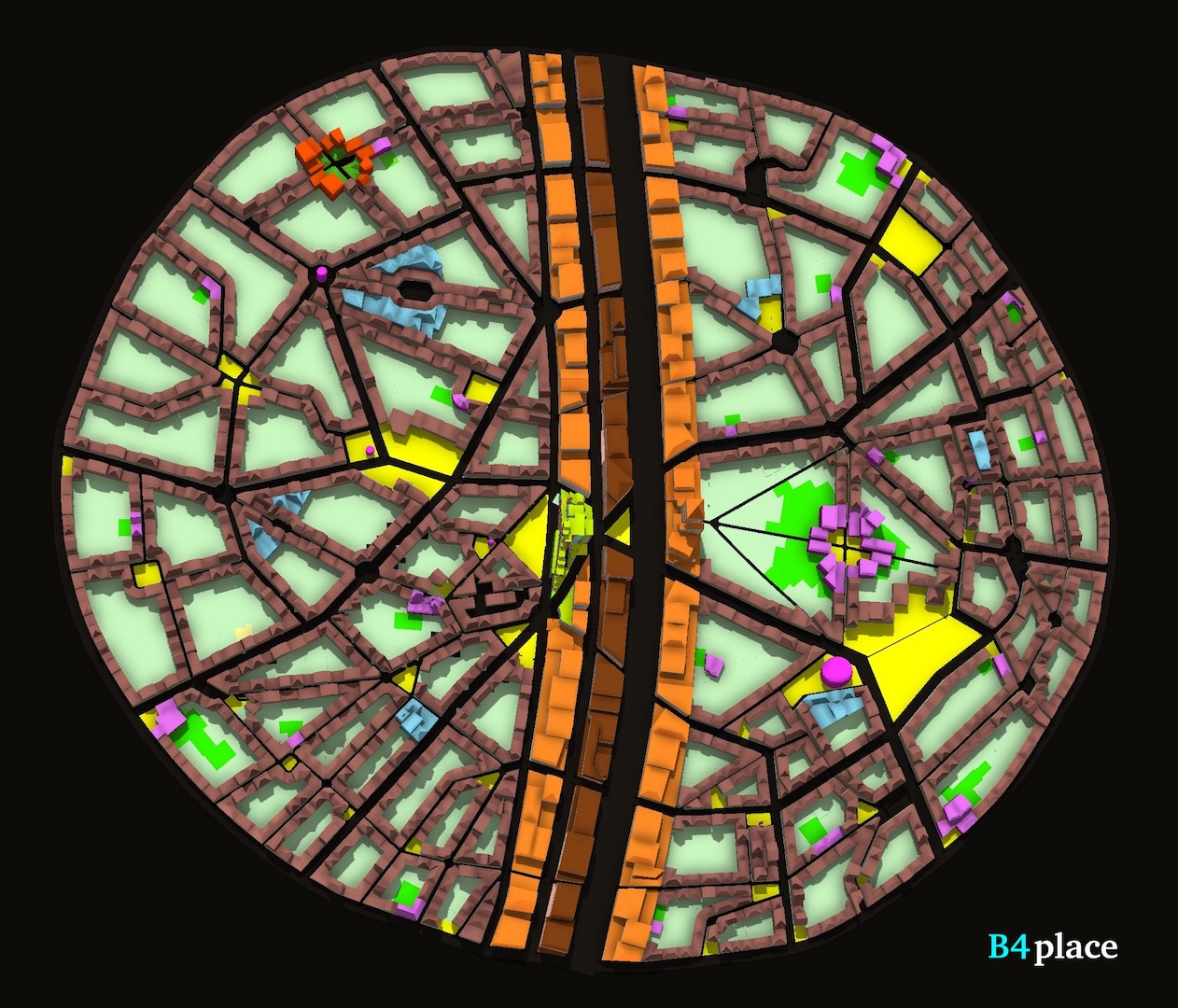
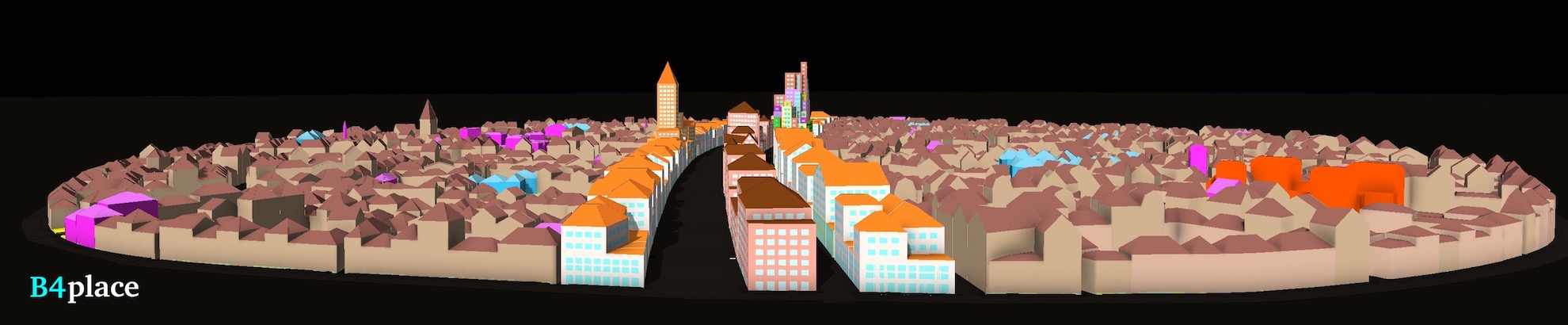
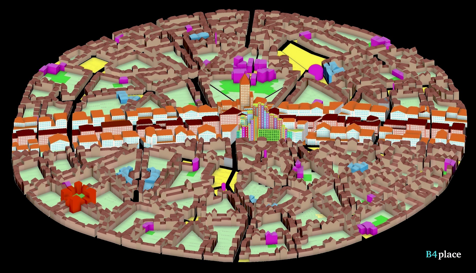
In our 3D model of the Carfree Reference District, we’ve taken the liberty of distorting it a bit and detailing out some of the specific building and space uses.
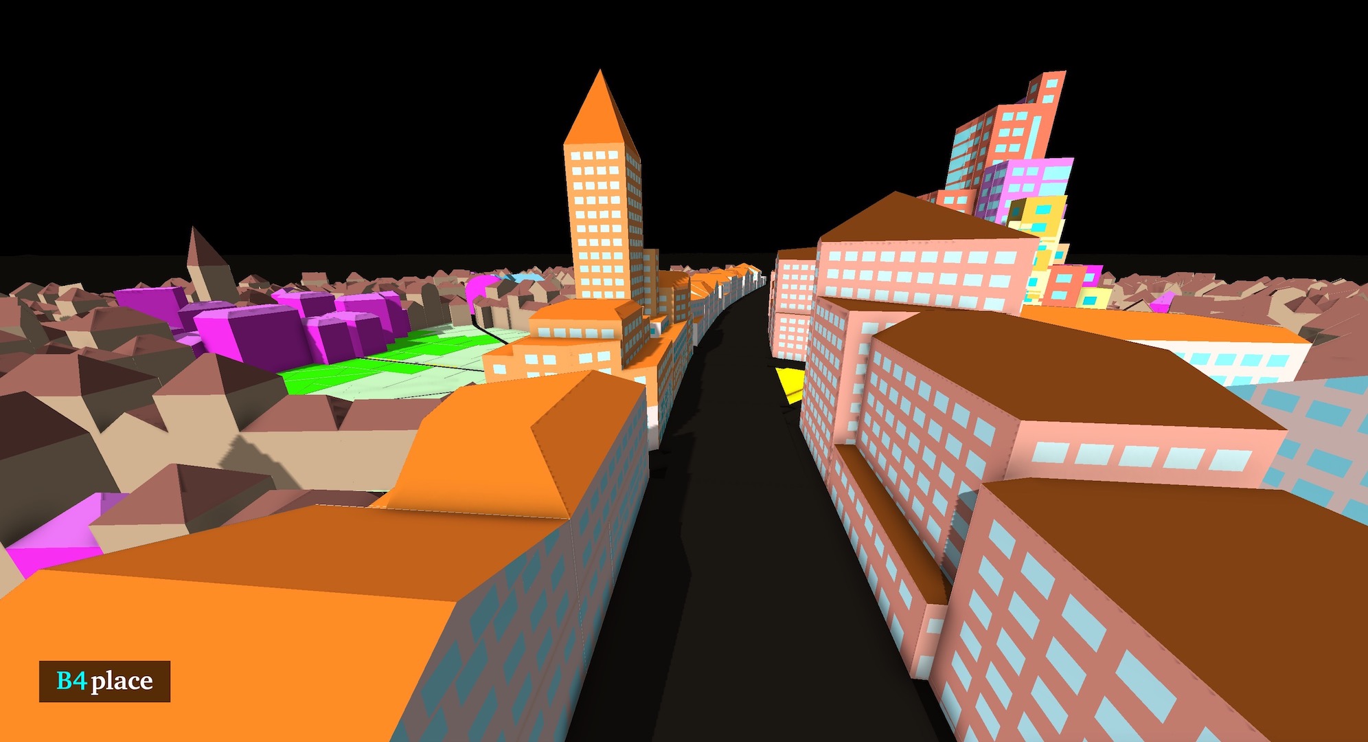
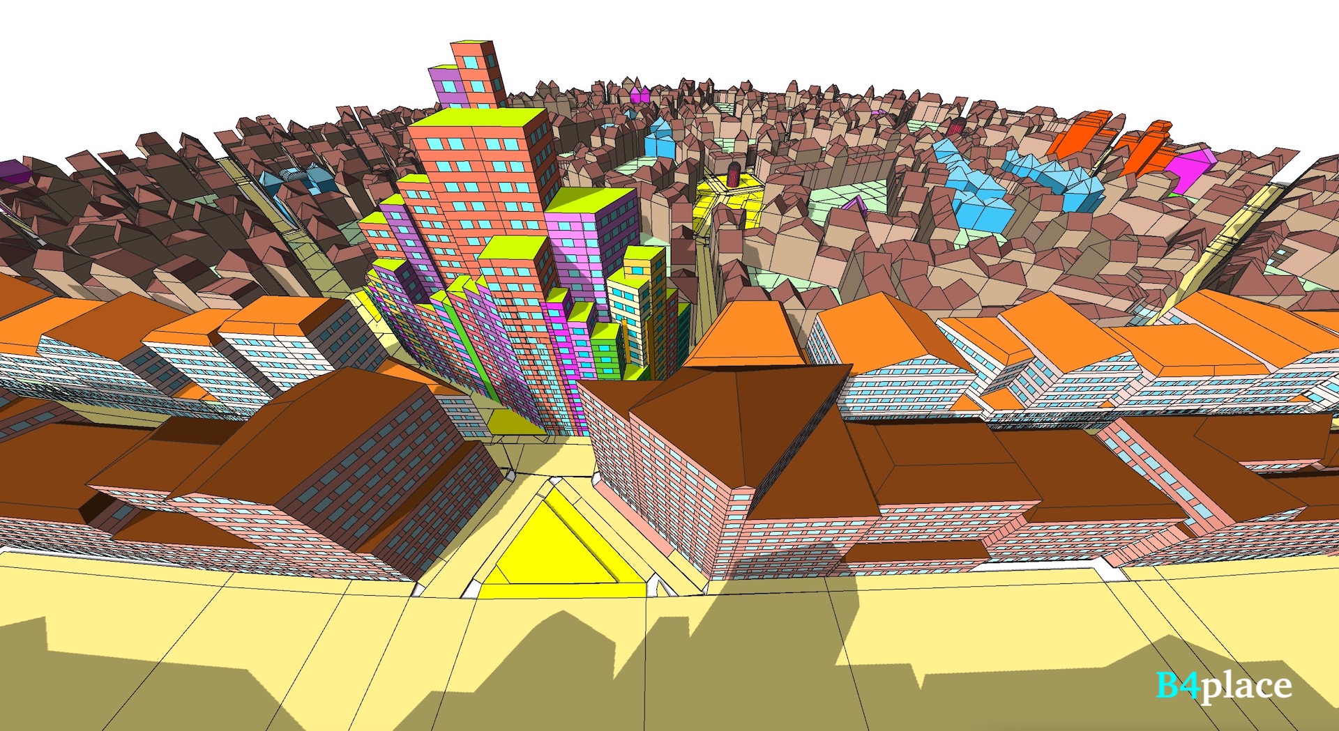
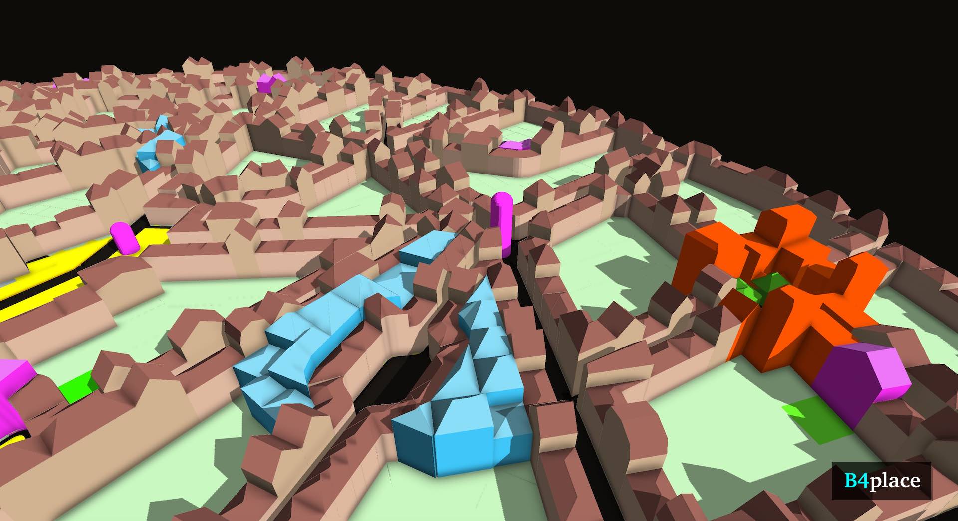
First, we added just a few taller buildings in the center of the district to give a sense of scale. They would be used as a hotel and a vertical library/university.
We also demarcated apartment arcades, schools, public spaces, a senior-citizen-oriented neighborhood, and other structure types within the fabric of the district, using brightly colored building shades. (See key above.)
Also, all buildings in the district are mixed-use, which includes the ability to have ground-floor workshops, studios, offices, and retail. The blue shopping arcades include upper-floor office and residential units over a number of ground-floor retail shops, including food halls.
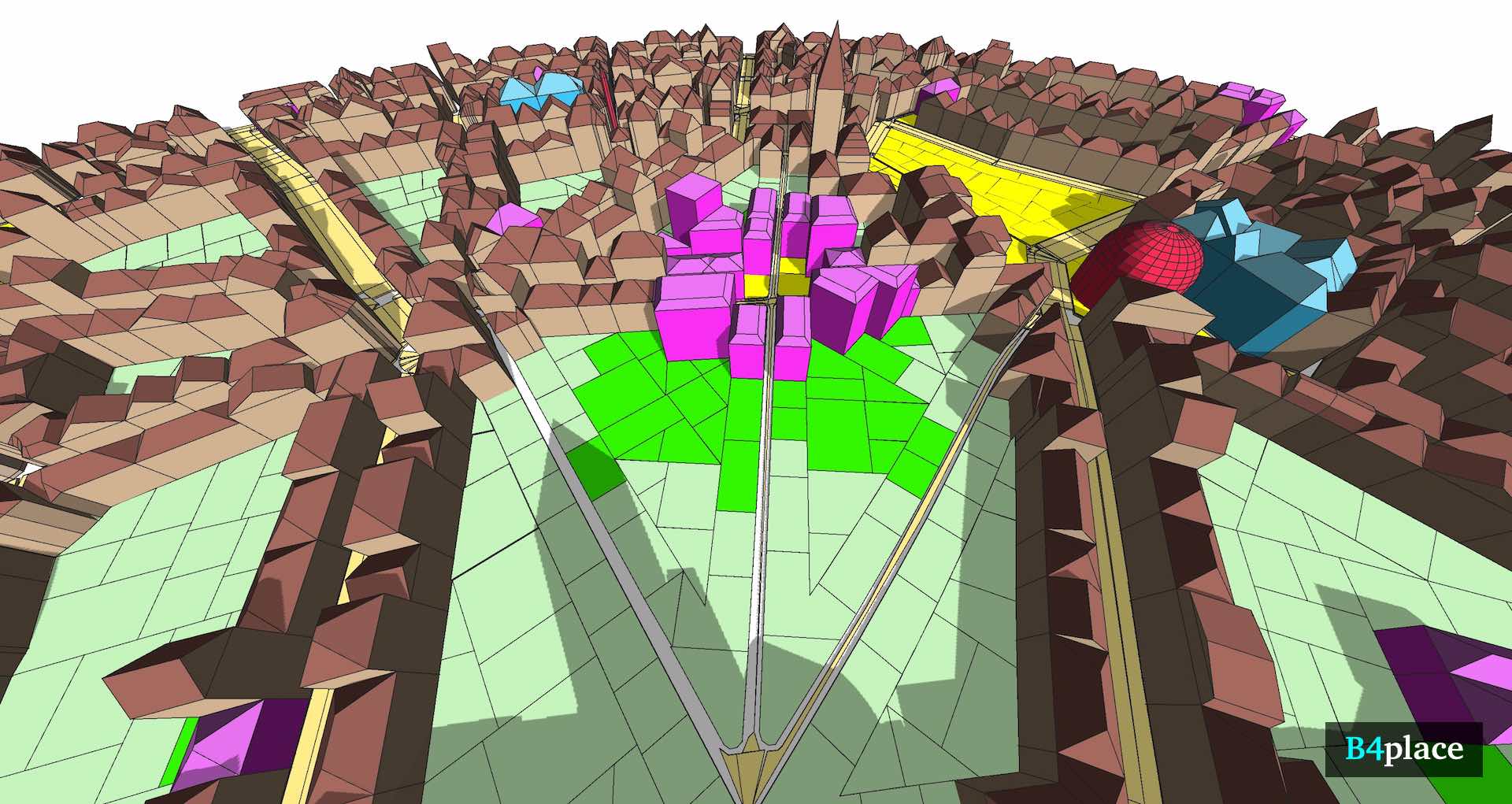
The schools in the district are magenta in the image. The numerous small ones are creches and elementary schools. Then there are three junior-high schools near the district peripheries. Lastly, there’s a high school with a quad, overlooking the large public green in the center of the district. The light green-colored areas are the private back gardens and public green spaces. The bright green areas show the school-adjacent outdoor spaces.
In the real world, these designs would be used as guides to the interplay between the district’s structures and spaces.
Click an image below to launch the gallery.
Check out our other Property Experiments here.